Murray Rd and Gaffney St - Accurately display gaps in Dedicated bike lanes

Summary: Google Maps Cycling layer often doesn't show gaps in Dedicated lanes. Substantial gaps in bike lanes usually have a considerable impact on cyclist safety and comfort. It also denies cyclists the opportunity to find safer alternate routes. Morevoer, hiding the gaps (or incorrectly labelling them "bicycle-friendly" instead) allows government agencies to escape their accountability to provide a genuine bikeway network.

Murray Rd and Gaffney St have a significant gap in the Dedicated bike lanes that provides a vital east-west cycling arterial in Melbourne's northern suburbs. In 2014, I previously tried to have these gaps displayed by editing Google Map Maker but my corrections were rejected without explanation. Google Maps has now been edited incorrectly to hide the missing bike lanes with incorrect "Trails" and "Bicycle-friendly roads." This needs to be fixed. The onroad gaps in cycling facilities need to be shown not hidden.

Status: Reported to Google Maps again on 1 July 2016 but not yet fixed.

Issue TypeIssue 7: Gaps in bike lanes should be displayed not concealed on Google Maps

Prior Google Maps Cycling Layer:
I've previously tried to correct the below section of Murray Rd and Gaffney St where the Dedicated bike lane disappears and cyclists are left to mix it with 60km/hr traffic or inconveniently walk their bike to piecemeal sections of footpath (now relabelled shared paths) on alternating sides of the road.

One thing is abundantly clear: no section of the road marked in red below has any useful cycling facilities. Hence, Google Maps should represent these roads accurately as gaps.
Issue 7: Gaps in bike lanes should be displayed not concealed on Google Maps

Google Maps Cycling Layer (as of 1 July 2016):
Since then, Google Maps Cycling layer has been mysteriously edited but only to hide the absence of cycling facilities. Some sections have been changed to "Bicycle-friendly roads" even though they are very unfriendly to cyclists. Others use the existence of useless, piecemeal footpaths (relabelled as shared paths) on alternating sides of the road to mark up the road in the safest colour (dark green Trails).


Google Maps Cycling layer - Murray Rd and Gaffney St

Despite the Google Maps changes, the reality of cycling on this road hasn't changed. The Dedicated bike lanes end and cyclists are left with no safe-enough, accessible cycling facilities. This is easily proven by simply reviewing the video below which accurately shows the change in cycling conditions on the entire length of this route:

YouTube IBHWGM - Murray Rd and Gaffney St (Darebin Creek to Moonee Ponds Creek)

St Georges Rd bike path to Miller St - Safer, popular connecting route should be accurately shown

Summary: Regular cyclists often use bidirectional offroad paths, pedestrian crossings and other links inaccessible to motor traffic to find safer and more convenient ways to navigate intersections and less safe road conditions. Unfortunately, Google Maps Cycling layer and Directions don't currently incorporate or prioritise many of these routes.

The connection between the St Georges Rd offroad bike path and Miller St is an excellent example of where Google Maps doesn't show the safer, convenient, offroad route most local cyclists take.

Status: Reported to Google Maps on 30 June 2016 but not yet fixed.

Issue TypeIssue 5: Safer intersection and connecting links should be prioritised in Google Maps Cycling layer

Google Maps Cycling Directions:
The cycling directions heading south west from the St Georges Rd bike path to Miller St are incorrect because Google Maps does not allow the bidirectional offroad trail that fully connects these streets to be added properly.

Consequently, its Cycling Directions incorrectly advise having to walk your bicycle 230m south along St Georges Rd (as a shared path cyclists can ride the whole way). The directions also incorrectly advise that the right hand turn restriction onto Miller St may apply - this can't apply to users of the offroad path:

Cycling Directions - St Georges Rd bike path to Miller St

The offroad trail that forms a safer, preferred connecting route in both directions can be seen below. These are exactly the kind of unobvious, high-value features a useful Cycling map needs to have. Cyclists don't need a Cycling layer to see the obvious routes cars or pedestrians take. But finding useful cycling-specific facilities is highly-desired.

Instant Street View - St Georges Rd offroad shared path near Miller St

Lygon St, Cemetery Rd and College Cres Shared Paths - Mark off-road Trails in actual location not centre of roadway

Summary: Many roads have off-road Trails ("shared paths") running alongside for the use of cyclists, pedestrians and other non-motorists. Unfortunately, current Google Maps policy results in many "parallel trails" not being marked where they are but inaccurately placed in the middle of the road.

Lygon St, Cemetery Rd and College Crescent are busy roads with no safe cycling space but have a shared path only on one side of the road. This off-road path should be drawn on Google Maps where it actually resides and with entrances/exits also marked up. This will allow cyclists and other potential users to access it and make safer and more convenient trips that avoid busy roads.

Status: Reported to Google Maps on 30 June 2016 but not yet fixed.

Issue Type: Issue 4: Off-road bike paths should be marked as trails not displayed as on-road routes

Google Maps Path and Directions vs Actual Trail:

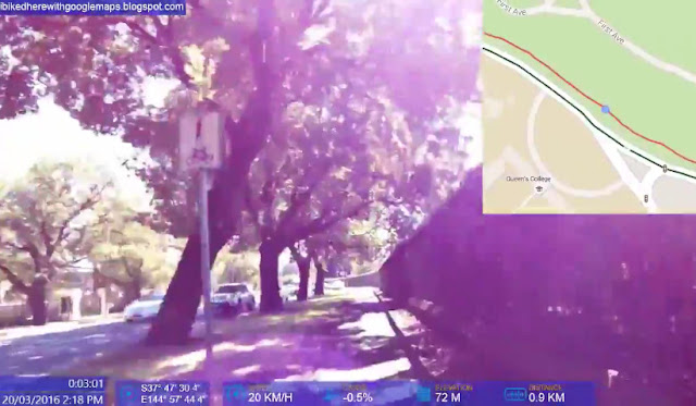
GPS Photo: The shared path off-road trail has parked cars, trees and a verge between it and the road. Marking it in the middle of this busy road is pointless. This trail is indistinguishable from a footpath until you are on it.
YouTube IBHWGM - Lygon St, College Cres and Royal Pde Shared Paths

Because Google Maps doesn't currently allow these trails to be marked accurately wherever they actually are, many off-road trail sections around intersections do not appear at all. Off-road trail users can only discover these by chance. The below shared path enables cyclists to avoid a busy, dangerous roundabout.
YouTube IBHWGM - Swanston St (Flinders St to College Cres)

Exhibition St between La Trobe St and Little Bourke St - Fix Dedicated lanes to indicate they are part-time only

Summary: This stretch of Exhibition St has Dedicated bike lanes only for a couple of hours (peak hour) of the day on weekdays only. Yet Google Maps displays permanent Dedicated lanes as if they are available 24/7.

Even worse, unlike some other part-time Dedicated lanes (e.g. Sydney Rd type), the type represented by Exhibition St do not provide any safe cycling space outside of the peak hour times. Cyclists then have to fully mix it with busy motor traffic.

Google Maps should differentiate these Part-time Dedicated lanes from permanent Dedicated lanes by using a variation of the green line symbol (e.g. with a symbol overlaid on the part-time sections).

StatusReported to Google Maps on 30 June 2016 but not yet fixed.

Issue TypeIssue 3: A new cycling layer classification for Part-time Dedicated lanes should be added to Google Maps

GPS Photo of Part-time bike lane: (Current Google Map: -37.808306,144.968944)
YouTube IBHWGM - Rathdowne St, Exhibition St, Batman Ave (Park St to Olympic Blvd)

GPS Photo of cycling conditions on Exhibition St outside of the peak hour period:
YouTube IBHWGM - Rathdowne St, Exhibition St, Batman Ave (Park St to Olympic Blvd)

As you can see, outside of the peak hour period, there are no Dedicated bike lanes, nor any informal cycling space mostly dedicated to cyclists. Riders have to mix it up with motor traffic in one of the traffic lanes.

As of 30th June 2016, Google Maps represented the Exhibition St part-time bike lanes the same as 24/7 Dedicated lanes like those on La Trobe St. This is clearly misleading for over 90% of the hours in a week.

Google Maps Cycling layer - Around Exhibition St


Further Info:

Bicycle Network
Inner: Exhibition Street/Batman Avenue

Barrow St between Rennie St and The Grove - Change to Bicycle-friendly road

Summary: Barrow St between Rennie St and The Grove is marked as having Dedicated lanes. There are no bike lanes but the street should be marked as a Bicycle-friendly road as it is part of a formal north-south back streets route.

Status: Reported to Google Maps on 17 Feb 2016 but not yet fixed.

Issue TypeIssue 2: Bike lanes that don't exist need to be removed from Google Maps

GPS Photo: -37.751136, 144.97125

Google Maps Cycling layer:
https://www.google.com.au/maps/place/37%C2%B045'04.1%22S+144%C2%B058'16.5%22E/@-37.7511317,144.9690613,17z/data=!3m1!4b1!4m2!3m1!1s0x0:0x0!5m1!1e3


Google Maps Instant Street View:
https://www.instantstreetview.com/@-37.751181,144.97126,181.76h,-12.38p,1z
Note how the outdated Street View images show that this street used to have bike symbols painted within a continuous parking lane that isn't wide enough to be shared. This imaginary bike space has been corrected on the ground but not yet reflected on Google Maps.

Holden St from St Georges Rd to Nicholson St - Delete Dedicated lane

Summary: Holden St from St Georges Rd to Nicholson St is marked as having Dedicated lanes. These bike lanes are actually Useless Door Zone Bike Lanes that provide no safe space for cycling. They should be deleted as they are dangerous for inexperienced cyclists and provide a disservice to experienced cyclists who use alternate east-west routes and wouldn't desire to ride within such lanes. Much safer alternate east-west cycling routes exist that should be used by Google Maps - the Capital City Trail and Barkly St.

StatusReported to Google Maps on 12 Feb 2016 but not yet fixed.

Issue TypeIssue 1: Useless Door Zone Bike Lanes need to be removed from Google Maps

Video: IBHWGM YouTube Channel - Holden St & Brunswick Rd - from Merri Creek to Sydney Rd

Video Capture Photo with GPS (1min 22secs): -37.779722, 144.984306

Google Maps Instant Street View:
https://www.instantstreetview.com/@-37.779732,144.984246,78.62h,5p,1z

Issue 20: Dirt/unpaved trails should be accurate, unsuited for most wheeled transport and avoidable

Summary: It appears Google Maps added the Dirt/unpaved trails classification to its Cycling layer to aid recreational users (walkers, hikers, mountain bikers) in finding dirt-like trails. These are marked in brown and differentiated from paved Trails in dark green.

However, there are a few issues and improvements needed to the handling of such trails:

- Firstly, it is too easy for map editors to incorrectly mark normal paved Trails as Dirt/unpaved trails without these erroneous edits being prevented. Recent edits have incorrectly classified many paved Trail sections as Dirt/unpaved which reduces the accessibility of these routes for users of wheeled transport (bikes, push scooters, skateboards, wheelchairs, prams, etc).

- From a wheeled transport perspective, the primary differentiator between normal dark green Trails and the brown Dirt/unpaved trails should be whether the surface is practical for most wheeled transport users. Some compacted dirt tracks are often useable and so should be dark green Trails. Some technically "paved" trails (e.g. rough cobblestones) aren't useable but are marked as normal Trails; they should be changed to dark brown.

- When the practical difference between normal Trails and Dirt/Unpaved trails is consistent and useful, it can then be used reliably via viewing the Cycling layer directly as well as using Directions with "Avoid Dirt/Unpaved trails" added to the route options.


Issue 19: Google Maps Cycling Directions should show accurate and practical routes through intersections

Summary: The feasibility, safety and convenience of navigating road intersections on a bike is a major factor in identifying practical routes. Unfortunately, Google Maps Cycling Directions often have various deficiencies in their intersection routes:

- Sometimes the cycling (and often walking) route is wildly incorrect and dangerous. While pedestrians can often figure it out on the spot, cyclists following Google's directions may be led into danger.
- They often suggest using the same path as motor vehicles even when most cyclists use safer options
- They often ignore cycling-specific intersection facilities or rules (recommended bike pathways, contra-flow sections, gaps in barriers, hook turns)
- When they do leverage pedestrian crossings and paths these "Walk your bicycle" sections are not obvious on the map (ideally "walk only" sections should be in a different colour)
- They often recommend cyclists take circuitous routes including multiple pedestrian/bike crossings
- Informal shortcuts are ignored even if most cyclists use them


Issue 18: Bike routes marked as Avoid should be visible in Google Maps Cycling layer

Summary: Experienced local cyclists and bike groups often expend significant time and effort marking roads most unsuited to cycling as "Avoid" using Google Map Maker (e.g. high speeds, high traffic volumes, no or dangerous bike facilities). However, these routes are not displayed as colour-coded lines in the Cycling layer. This data is only used in charting Cycling Directions.

The problem is that the Cycling Directions are rarely used by most cyclists as their suggested routes are almost never the best or most useful. Most cyclists using Google Maps are simply viewing the Cycling layer green lines and then occasionally Street View as well.

So a desirable change is for the Cycling layer to display roads where Bicycle Suitability = Avoid -- ideally with thin red lines to contrast with the green lines. Note that the Cycling layer does show roads where Bicycle Suitability = Preferred -- these are the dashed green routes defined as Bicycle-friendly roads.


Issue 16: The Bicycle-friendly roads classification should be used selectively for genuinely useful routes

Summary: According to Google Maps, the dashed green Bicycle-friendly roads classification indicates "roads that are designated as preferred for bicycling, but without dedicated lanes." In practice, there is no consistent threshold of safety or comfort for a road to be marked as Bicycle-friendly.

It is highly desirable for the Bicycle-friendly roads classification to be explained officially in more detail as the intended way to add only recommended on-road bike routes that don't have Dedicated lanes. These recommended on-road routes should then be added systematically and comprehensively to build out a strategic grid of cycling routes that are dense enough and well-connected.